Key Takeaways
- Typhoons and hurricanes are both intense tropical cyclones but are named based on the regions they occur in.
- Typhoons typically form in the Northwest Pacific Ocean, while hurricanes develop in the Atlantic Ocean and Northeast Pacific.
- Both systems have similar structures and life cycles, but regional atmospheric conditions can influence their behavior and intensity.
- Differences in monitoring agencies, naming conventions, and seasonal timing distinguish typhoons from hurricanes.
- Understanding regional impacts and preparedness protocols is crucial for mitigating damage caused by these storms.
What is Typhoon?
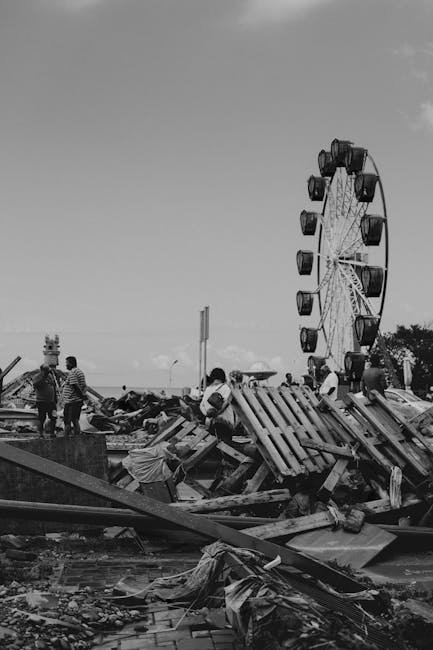
Table of Contents
A typhoon is a mature tropical cyclone that forms in the Northwest Pacific Ocean, particularly between 100°E and 180°E longitude. It is characterized by strong winds and heavy rainfall, often affecting East and Southeast Asia.
Formation and Development
Typhoons develop over warm ocean waters where sea surface temperatures exceed 26.5°C, providing the energy needed for their growth. They typically begin as tropical depressions, intensify into tropical storms, and then escalate into typhoons with sustained winds surpassing 74 mph.
The warm waters of the Western Pacific offer a vast, favorable environment for typhoon formation, making this region the most active basin globally. Seasonal wind patterns and the Intertropical Convergence Zone (ITCZ) also contribute to the genesis of these storms in this area.
Geographical Impact Zones
Countries such as the Philippines, Japan, Taiwan, China, and Vietnam frequently experience typhoons, which can cause significant damage to coastal infrastructure. These storms often bring storm surges, flooding, and landslides, especially in mountainous and low-lying regions.
For example, Typhoon Haiyan in 2013 devastated parts of the Philippines, highlighting the extreme hazards posed by these cyclones. Preparedness in these regions often includes evacuation plans and infrastructure designed to withstand strong winds and flooding.
Intensity Classification
The Japan Meteorological Agency (JMA) and other regional bodies classify typhoons by wind speed and pressure to assess their severity. Typhoons are often categorized as “severe” or “super typhoons” when their sustained winds exceed 130 mph.
This classification helps governments and emergency services issue timely warnings and mobilize resources. The Saffir-Simpson scale, while used globally for hurricanes, is adapted differently in the Western Pacific to describe typhoon strength.
Monitoring and Forecasting Agencies
The primary agency responsible for monitoring typhoons is the Japan Meteorological Agency, supported by the Philippine Atmospheric, Geophysical and Astronomical Services Administration (PAGASA) for local warnings. These agencies use satellite imagery, radar, and modeling to predict typhoon tracks and intensities.
Advances in forecasting technology have improved the lead time for warnings, reducing casualties and economic losses. International collaboration between meteorological organizations enhances the accuracy and dissemination of typhoon information.
Societal and Economic Effects
Typhoons can disrupt millions of lives by damaging homes, agriculture, and critical infrastructure such as power lines and transportation networks. The economic impact often runs into billions of dollars, especially in densely populated urban centers.
Recovery can take months or years, depending on the storm’s intensity and the affected region’s resilience. Governments and NGOs often coordinate relief efforts to restore normalcy and rebuild affected communities.
What is Hurricane?
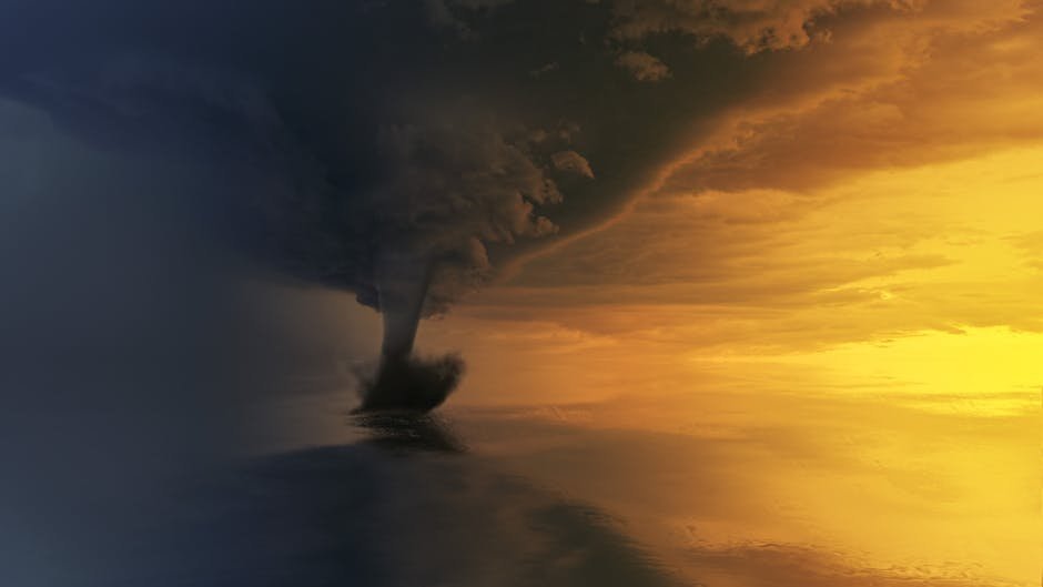
A hurricane is a tropical cyclone occurring in the Atlantic Ocean and the Northeastern Pacific Ocean, marked by strong winds and intense rainfall. It poses significant threats to the Caribbean, the United States, and parts of Central America.
Genesis and Evolution
Hurricanes form over warm ocean surfaces, usually when sea temperatures exceed 26.5°C, similar to typhoons. The process begins with disturbances such as tropical waves that organize into cyclonic systems under conducive atmospheric conditions.
The Atlantic hurricane season typically runs from June to November, peaking between August and October. Wind shear, humidity, and ocean heat content influence whether a system strengthens into a hurricane.
Areas Frequently Affected
Coastal states such as Florida, Texas, and Louisiana, along with island nations in the Caribbean, regularly face hurricanes. These storms often generate storm surges that can inundate coastal cities and cause extensive flooding inland.
Hurricane Katrina in 2005 stands as a stark example, causing widespread devastation in the Gulf Coast region. Emergency preparedness and evacuation protocols have since been enhanced in many vulnerable areas.
Intensity Scales and Categories
Hurricanes are classified using the Saffir-Simpson Hurricane Wind Scale, which ranges from Category 1 to Category 5 based on sustained wind speeds. Category 5 hurricanes have winds exceeding 157 mph and can cause catastrophic damage.
This scale assists meteorologists and emergency managers in conveying potential risks and necessary precautions. Unlike typhoons, which may have additional regional classifications, the Saffir-Simpson scale is standardized for the Atlantic basin.
Forecasting Organizations
The National Hurricane Center (NHC) in the United States is the primary body responsible for tracking and issuing warnings on hurricanes. It utilizes satellite data, reconnaissance aircraft, and computer models to predict storm paths and intensities.
Collaboration with other agencies in the Caribbean and Central America ensures that warnings reach all potentially affected populations. Advances in technology have significantly increased forecasting accuracy over the past decades.
Economic and Human Consequences
Hurricanes often cause widespread power outages, displacement, and destruction of property, leading to long-term economic challenges. Insurance claims and government aid programs commonly surge following major hurricanes.
In addition to physical damage, hurricanes can disrupt local economies by affecting agriculture, tourism, and industry. Recovery efforts involve rebuilding infrastructure and addressing public health concerns such as waterborne diseases.
Comparison Table
The table below highlights several critical aspects differentiating typhoons and hurricanes by region, impact, and classification criteria.
| Parameter of Comparison | Typhoon | Hurricane |
|---|---|---|
| Regional Occurrence | Northwest Pacific Ocean and adjacent coastal countries | Atlantic Ocean, Gulf of Mexico, and Northeastern Pacific Ocean |
| Seasonal Peak | May to October, with peak activity in late summer | June to November, peaking from August to October |
| Wind Speed Classification | Uses categories such as severe and super typhoon based on local scales | Classified by Saffir-Simpson scale from Category 1 to 5 |
| Monitoring Agencies | Japan Meteorological Agency, PAGASA, and regional meteorological centers | National Hurricane Center and regional meteorological services |
| Commonly Affected Countries | Philippines, Japan, China, Taiwan, Vietnam | USA, Caribbean nations, Mexico, Central America |
| Storm Surge Impact | Typically causes significant coastal flooding in East and Southeast Asia | Major contributor to coastal flooding in the Gulf Coast and Caribbean |
| Naming Conventions | Names follow lists determined by regional committees including Asian countries | Names are assigned from pre-determined lists managed by the World Meteorological Organization |
| Average Storm Duration | Usually lasts 3 to 7 days over water before landfall or dissipation | Typically persists for 5 to 10 days from formation to dissipation |
| Economic Impact Focus | Primarily damages agriculture, fisheries, and coastal infrastructure in |